2013-06-15 Red Deer Lake
You can see the GPS tracks for this entire hike.
The video shows: Coney Flats 0:00-1:07, near Buchanan Pass Trail 1:08-1:54, above Red Deer Lake 1:55-2:28, Red Deer Lake 2:29-3:15, on return near Buchanan Pass Trail 3:16-3:34.
Parking on the north side of Beaver Reservoir, we were surprised to find Coney Creek Road (Forest Rd 507) still closed. Starting our hike at 9:07, we proceeded up Coney Creek Road. The road was just wet in places, but free of snow, except very small patches in the forest near Coney Flats. The creek crossing just before Coney Flats Trailhead had high water.
At the trail intersection of Coney Flats, we took the right branch (Beaver Creek Trail), where the left branch is the Coney Lake Trail. Once the trail reached the beginning of the Coney Island east ridge it became mostly covered in snow and we soon lost track of it. Because of the snow, we completely missed the intersection with the Buchanan Pass Trail which we wanted to take to get to Red Deer Lake, and ended up hiking well past it.
Eventually, we got to Red Deer Lake by hiking north, then northeast around the lower ridge of Red Deer Mtn, and then northwest to the lake, as the GPS tracks show.
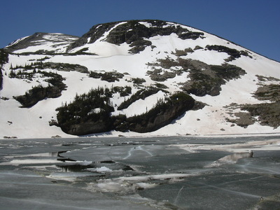
We reached Red Deer Lake at about 12:40. The lake was still covered with ice. After having lunch there, we returned mostly the way we came, but not going as far west to reach the Buchanan Pass Trail. At one point we had to do a little backtracking because soft snow made the going very slow.
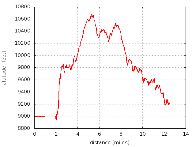
Returning to Beaver Reservoir at 16:44, our tracks show distance traveled was 12.5 miles. The minimum altitude was 9,216 ft at the parking area, and the maximum was 10,669. For the elevation profile below, a little over the first 2 miles is not accurate because the GPS wasn't tracking well.

2013-06-15 Elevation profile: Beaver Reservoir to Red Deer Lake and back
| Place Name | Elev [ft] | Accuracy [ft] | Position (lat,lon) |
|---|---|---|---|
| Parking at Beaver Reservoir | 9,216 | 23 | 40.12127,-105.52394 |
© 2012-2013 Stefan Hollos and Richard Hollos
Tweet

blog comments powered by Disqus