Knob 8092 of Nugget Hill, 03/08/2008
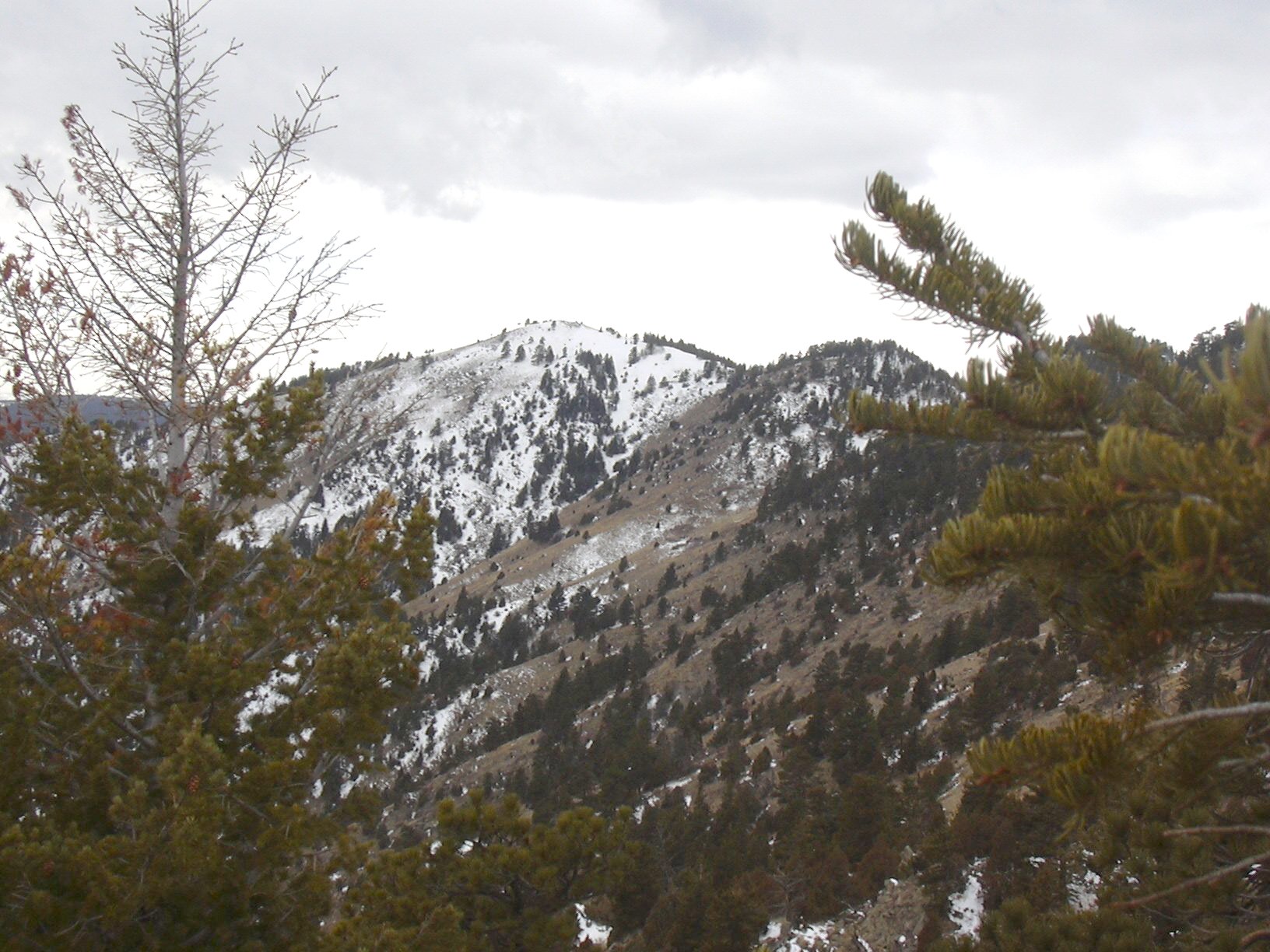
Nugget Hill summit from top of Knob 8092, 03/08/08
Driving up Lefthand Canyon from US Hwy 36, we parked near the intersection of the road to Jamestown and the road to Ward. Starting at 11:13, about 0.15 mile up the road to Ward, we began hiking up a steep slope, heading northwest, and gained the ridge of Nugget Hill.
Running up the ridge of Nugget Hill, it was an intense climb, and the first 1/2 mile we gained 800 ft in elevation. The terrain is not bad, starting with meadow and juniper, it got more forested as we reached the top of Knob 8092, but it wasn't a terribly rugged terrain.
On the ridge, just before the top, we came upon some fresh large cat tracks in the snow. Nearby were a few little trees whose bark was mostly scratched off. The tracks disappeared over the steep north side of the ridge.
On the top of Knob 8092, the odometer showed 1.31 miles, and the elevation gain from the parking place was 1,757 feet. Looking southwest, we could see quite a bit of snow just below the summit of Nugget Hill. Not feeling like trudging through deep snow, we nixed the idea of getting to the Nugget Hill summit, and instead decided to explore the south slope of Knob 8092.
Leaving the top of Knob 8092, we followed the ridge west for about 0.1 mile before beginning our descent through a meadow interspersed with juniper trees. Instead of going straight down to the Lefthand Canyon Road, our path formed a counterclockwise arc across the south slope of Knob 8092.
At one point in our descent, we heard what sounded like a large animal making haste and crashing through forest debris, and then we saw an elk with the largest set of antlers we'd ever seen. Within a few seconds, he was gone, before we could get a picture. He got spooked by us, and we felt fortunate he ran away from, and not toward us.
We eventually came out onto Lefthand Canyon Road, about 2/10 mile downhill from its intersection with Lee Hill Road. From there we hiked back along the road to our parking place, getting back at 14:40.
On our return, the odometer showed 3.3 miles. The total trip time was 3 hrs, 27 minutes. Although short, the climb was intense, and was a real wilderness hike, having found fresh signs of a mountain lion, and seen an elk with tremendous antlers.
| Place name | Elev [ft] | Accuracy [ft] | Lat/Lon |
|---|---|---|---|
| Parking near Lefthand Cnyn/Ward Rd inters. | 6400 | 15 | 40.10022/105.34370 |
| Knob 8092 | 8157 | 16 | 40.09820/105.36217 |
| Began descent | 8053 | 18 | 40.09777/105.36436 |
| Return to Lefthand Canyon Road | 6574 | 31 | 40.09502/105.34963 |
| Number | Description | Lat/Lon |
|---|---|---|
| 1 | Nugget Hill summit (8582') | 40.0911/105.3814 |
| 2 | Ridge Knob 1 (8485') | 40.0961/105.3772 |
| 3 | Ridge Knob 2 (8415') | 40.0975/105.3726 |
| 4 | Ridge Knob 3 (8092') | 40.0981/105.3622 |
| 5 | Ridge Point @ 7200' | 40.1032/105.3522 |