Peak 7790 from Button Rock Preserve, 12/02/2007
Peak 7790 is #69 on Gerry Roach's Boulder County Peaks List.
Getting to the Button Rock Preserve parking area at about 9:45, there was not a single car parked there. Considering it was the Christmas shopping season, and that it was quite cold and snowy, it wasn't a surprise we were the only ones there.
We started hiking at 9:51. Walking about 200 feet east on the entrance road, we then headed up a steep slope along a gulley in the northwest direction. This northwest direction we would generally maintain all the way to Peak 7790.
We soon came upon a herd of deer in a clearing. Remarkably, they seemed to be very curious about us and just stood there looking, apparently never having encountered a person intent on shooting at them.
The way soon leveled out as we began hiking along a wide ridge and followed an old road for awhile, then left the road, continuing northwest through a large meadow with an old cabin in it.
Past the meadow, the slope got steep again as we ascended about 800 feet in elevation through ponderosa forest. The way then leveled out, and the last 1/3 of the way we only gained about 400 feet, as we continued northwest to Peak 7790.
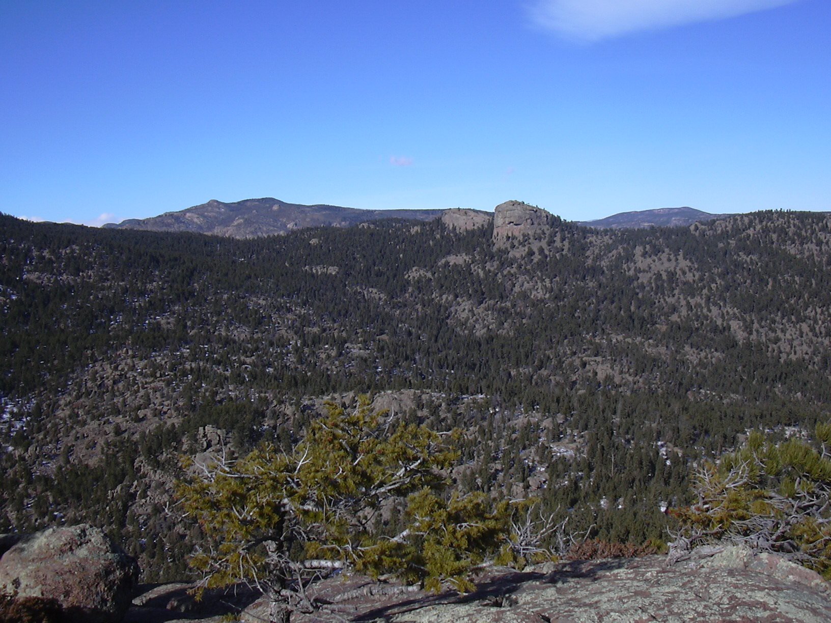
Button Rock from summit of Peak 7790, 12/02/07
This part of the hike is particularly pristine ponderosa and Douglas fir forest, with a complex topography created by ancient weathered granite.
We reached the summit of Peak 7790 at 11:28. On the summit, the odometer showed 2.28 miles. The summit of Peak 7790 is unusual in the fact that it's on the edge of a relatively flat area with other granite knobs nearby that appear to be roughly of equal height.
The summit of Peak 7790 has nice views. The most striking view is Button Rock to the north, and the expanse of unblemished wilderness that you can look down at, between you and Button Rock. Kenny Mountain can be seen just to the left of Button Rock. To the west, you can see Button Rock Mountain, and just to its left, Copeland Mountain in the background.
Because of the cold, we didn't stay long on the summit, but came down off the summit knob and explored the plateau that the summit knob is on. Near the summit, there is a sandy meadow that appears to be a silted up pond. From there we investigated other knobs on the plateau in a clockwise direction, before heading back.
We didn't exactly retrace our steps, but formed a narrow loop in a clockwise direction before getting back on our incoming tracks, past the large meadow.
We returned to the parking area at 14:48, where the odometer showed 5.66 miles. This hike took about 5 hours, which included a long stop for lunch. The elevation difference from the parking place to the summit was 1,820 feet.
Topomap of the Peak 7790 area.
| Place name | Elev [ft] | Accuracy [ft] | Lat/Lon |
|---|---|---|---|
| Button Rock Preserve parking area | 5996 | 19 | 40.22875/105.34151 |
| Peak 7790 summit | 7816 | 16 | 40.24926/105.36229 |
| Number | Description | Lat/Lon |
|---|---|---|
| 1 | Knob 6710 | 40.2318/105.3524 |
| 2 | Ridge knob | 40.2378/105.3568 |
| 3 | Peak 7790 | 40.2491/105.3623 |