St. Vrain Mountain (12162') via Rock Creek, 06/28/2008
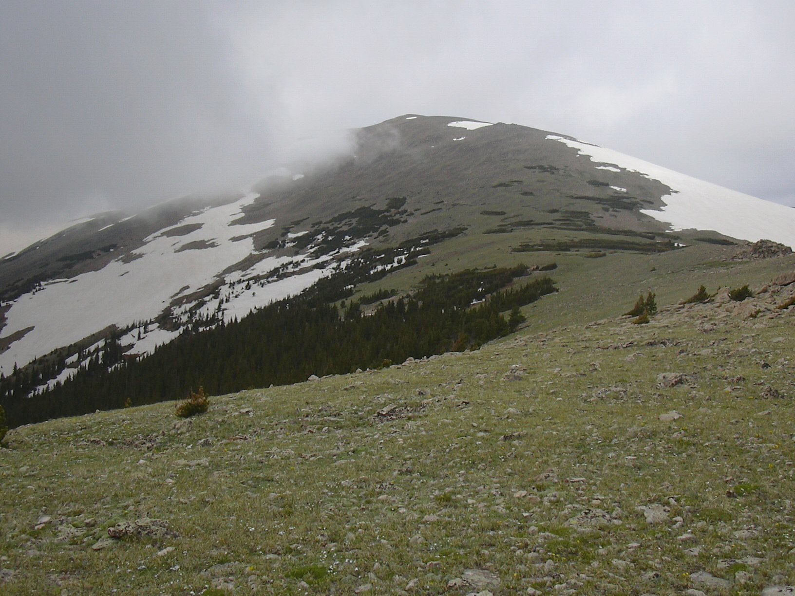
St. Vrain Mountain from east ridge, 06/28/08
St Vrain Mtn is Roach #32. The Rock Creek route up St Vrain Mtn is an alternative to the customary St Vrain Mtn Trail.
You can see the GPS tracks for this entire hike. There are some gaps, due to the GPS not tracking.
St Vrain Mtn via Rock Creek is one of our favorite hikes. With an altitude gain of 3,455 feet over a distance of 5 miles, it's intense exercise. While the first part is packed with summertime campers along Rock Creek, you soon pass them by, and you enter Engelmann spruce forest, followed by Limber pine, and then alpine meadow with a background that seems to come out of the Sound of Music. In our several visits here, we've never met anyone, past the campsites, until the intersection with the St Vrain Mtn Trail route near the summit.
From Allenspark, taking Road 107 (Ski Road) south until it becomes Forest Road 116, we continued past Moss Rock Drive (this goes to the Saint Vrain Mtn Trailhead) and continued for about 0.4 miles, then parked in the vicinity of the campsites scattered along Rock Creek.
We started hiking at 10:19, heading south on Forest Rd 116. Then where the road takes a sharp left (south), we turned right, heading northwest toward Rock Creek. Reaching Rock Creek, we hiked up along its south bank for about 0.2 miles, until a swath of meadow appeared to our left. From there we left the creek, and followed the meadow southwest, then west, until reaching the east ridge of St Vrain Mountain. We then followed the ridge northwest, then west to the summit of Saint Vrain Mountain.
We reached the summit at 12:33, with the odometer showing 4.94 miles. The weather was unusual, with a moist east wind piling up clouds around the mountain. Being surrounded by clouds, there were no views, and we got the impression of standing on the wing of a jetliner as it carved its way through clouds.
Heading back down, we made good time by sliding down the snowy east slope. There seemed to be more snow than usual for this time of year. Following the east ridge down, we stopped for lunch along the way, and returned south of our incoming tracks, before reaching the road again at about 10,300 feet.
We returned to our parking spot at 15:32, for a total trip time of 5 hrs, 13 minutes. The total distance was about 10 miles, with a 3,455 ft elevation gain.
- Richard Hollos and Stefan Hollos
| Place name | Elev [ft] | Accuracy [ft] | Lat/Lon |
|---|---|---|---|
| Parking place off Rock Creek | 8753 | 30 | 40.16965,-105.53008 |
| Saint Vrain Mountain summit | 12208 | 17 | 40.16125,-105.58571 |