Walker Crest (8940'), Walker Mtn (8825') and Nugget Hill (8582') from Lefthand Canyon Road, 05/04/2008
Walker Mtn from Nugget Hill, 05/04/08
Walker Crest is Roach #43, Walker Mountain is an unranked Roach, while Nugget Hill is Roach #S10.
We parked off Lefthand Canyon Rd, just west of Rowena, where a 4WD road starts up Nugget Hill. Our route began by taking the 4WD road to the top of the ridge, then turning right to bag Nugget Hill summit, returning to our ridge starting point, then heading west along the ridge to Walker Crest, and finally bag the summit of Walker Mountain. The entire route is shown on this map.
Starting our hike at 10:16, from Lefthand Canyon Rd (7190 ft) to the top of the ridge (8305 ft) is a steep climb of 1115 feet on a 4WD road. At the ridge top, we turned right onto Forest Rd 509-3D heading toward Nugget Hill summit. We first ascended a knob that tops out at 8582 ft, then descended to a saddle (8452 ft), and finally ran up to the summit (8595 ft), getting there at 11:18. The forest road goes all the way to the summit.
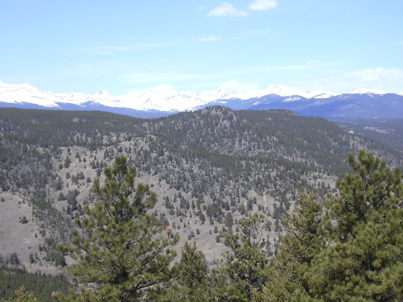
The views from Nugget Hill summit turned out to be the best of the entire hike. To the north were (left to right) Bald Mountain, Porphyry Mountain, Golden Age Hill, and Fairview Peak. To the west and northwest were Walker Crest and Walker Mountain. And to the south were (left to right) Lee Hill, Butzel Hill, and Bighorn Mountain.
Going back the way we came, we returned to the ridge top point at 11:49 with the odometer at 3.52 miles. From there we headed west, then north to Walker Crest. We started on a 4WD road, then just ran along the ridge. The terrain was pretty easy.
We reached Walker Crest at 12:27, with the odometer showing 4.92 miles. Walker Crest is a non-distinct rock knob in a relatively flat forest. There are no views, and there was no summit register. It would be hard to locate this summit without a GPS.
From Walker Crest, we headed north toward Walker Mountain. We soon came upon a forest road, which we followed, turning right at the first fork in the road, then left, then right from FR 509 to 509-1A. The forest road continued to just below the summit.
At 13:10, we got to the summit of Walker Mountain, with the odometer showing 6.15 miles. The summit of Walker Mountain has trees, but there are some views. You can see Mt Meeker, and on the east side of the summit area, Nugget Hill.
For a trail register, there is only an old broken glass jar with two small pieces of paper. There was just one entry, dated 9/24/06. This surprised me, since the summit is not very far from Jamestown.
We returned approximately the way we came, getting back to the parking place at 15:49, with the odometer showing 11.3 miles.
The total altitude gain for this hike was approximately 2250 feet, and the total time was about 5 1/2 hours, with a long lunch thrown in.
| Place name | Elev [ft] | Accuracy [ft] | Lat/Lon |
|---|---|---|---|
| Parking below Nugget Hill | 7190 | 27 | 40.07733/105.39240 |
| Top of Ridge | 8305 | 14 | 40.08580/105.39233 |
| Nugget Hill summit | 8595 | 15 | 40.0912/105.3814 |
| Walker Crest summit | 8940 | 14 | 40.08858/105.41091 |
| Walker Mountain summit | 8844 | 15 | 40.09867/105.40860 |
| Number | Description | Lat/Lon |
|---|---|---|
| 1 | Parking (just west of Rowena) | 40.00735/105.39204 |
| 2 | Walker Crest (8940') | 40.088349/105.410771 |
| 3 | Forest Rd intersection | 40.0907127/105.415020 |
| 4 | Walker Mtn (8825') | 40.098723/105.40884 |
| 5 | Nugget Hill (8582') | 40.0913036/105.381460 |