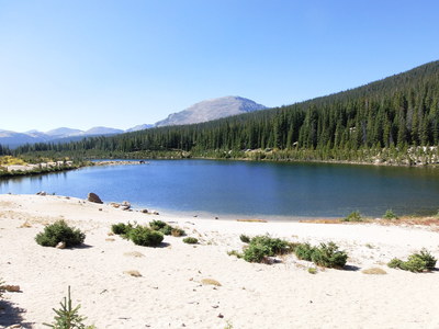
Starting at 9:43 from the Wild Basin Ranger Station (8586 ft), we hiked upstream along Hunters Creek. It soon became very thick with vegetation and dead trees as the slope steepened. We kept the creek within earshot to our left as we ascended. Once the climb leveled off at about 9400 feet, the going got much easier with less dense forest and smoother terrain. We stumbled upon the Hunters Creek Campsite and then the Sandbeach Lake Trail (9667 ft @ 40.21627,-105.581090). On the Sandbeach Lake Trail we headed west (left) to Sandbeach Lake, getting there at 11:23.

2014-09-20 Sandbeach Lake
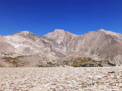
From Sandbeach Lake, we headed over to the northwest corner of the lake, then followed an unofficial trail that weaves through forest, with some extremely large diameter trees, to the Orton Ridge. Above treeline, we followed the ridge up to the summit of Mt Orton, getting there at 12:45. We saw no register or marker of any kind on the summit.

2014-09-20 Pagoda, Longs, and Meeker from North Ridge
From the summit we headed northwest along North Ridge to a low point on the ridge. From there we began a gradual descent in a northwest direction toward Castle Lake. On the way down, we found a pair of gloves someone had dropped on the tundra.
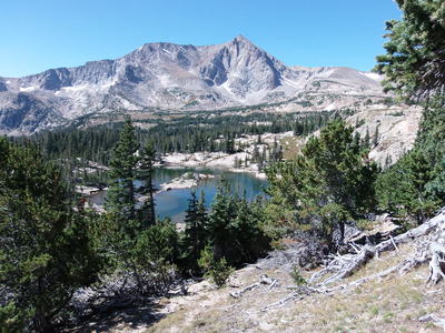
There is an elk trail from Castle Lake up to the ridge, which we eventually found and descended by. At this point, the descent is very steep, and also quite tricky. If you don't find this trail, you could find yourself above cliffs and you'll have to backtrack. It's best to do this the other way and ascend from Castle Lake. We've done this route many times, and so had a wee bit of confidence we could find the right way down. We were quite happy to eventually see Castle Lake below, and we got down with no problem.

2014-09-20 Castle Lake with Mt Alice
Having lunch at Castle Lake, we then proceeded to Lion Lake #1, then headed back along the Lion Lake Trail, returning to the parking area at 17:30.

2014-09-20 Lion Lake #1 with Mt Alice

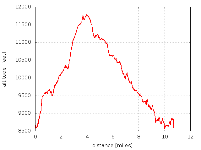
2014-09-20 Elevation profile: Sandbeach Lake - Lion Lake #1 Loop
| Place Name | Elev [ft] | Accuracy [ft] | Position (lat,lon) |
|---|---|---|---|
| Parking at Wild Basin Ranger Station | 8543 | 20 | 40.20793,-105.56689 |
| Wild Basin Ranger Station | 8586 | 30 | 40.20796,-105.56632 |
| Mt Orton summit | 11763 | 20 | 40.22717,-105.61970 |
| High point on North Ridge | 11783 | 20 | 40.22876,-105.62400 |
© 2012-2014 Stefan Hollos and Richard Hollos
Tweet

blog comments powered by Disqus