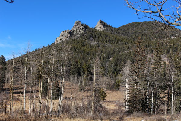
2022-12-11 Three Buttresses with Thorodin Mountain
We hiked up Thorodin Mountain from Gap Road on Dec 11, 2022.
The name of this mountain suggests the auditory environment at a drumming school, or the concatenation of two Norse god names. The origin of the name is the latter. At 10,540 ft (3,213 m), it's the highest peak in Golden Gate Canyon State Park.
From Longmont we drove south to Boulder then south on CO Hwy 93 toward Golden, then west up Coal Creek Canyon Road, and left onto Twin Spruce Road. In Golden Gate Canyon State Park, we parked at the Gap Road Access to Tremont Mountain, just past Harmsen Ranch.
Driving distances:- From intersection of CO Hwy 93 and Coal Creek Canyon Rd to intersection of Coal Creek Canyon Rd and Twin Spruce Rd: about 7 1/2 miles. Note that Google Maps indicates this distance is 8.7 miles which is about 1.2 miles too long.
- Intersection of Coal Creek Canyon Rd and Twin Spruce Rd to the parking place for Thorodin Mtn: 6.9 miles. Note that Twin Spruce Rd becomes Gap Rd at a sharp bend.
Note that Google Maps mislabels the peak as being on a north knob of the mountain. On the other hand, it is correctly labeled on topomaps like this one.

2022-12-11 Lookout tower on Starr Peak from near Thorodin Mountain summit

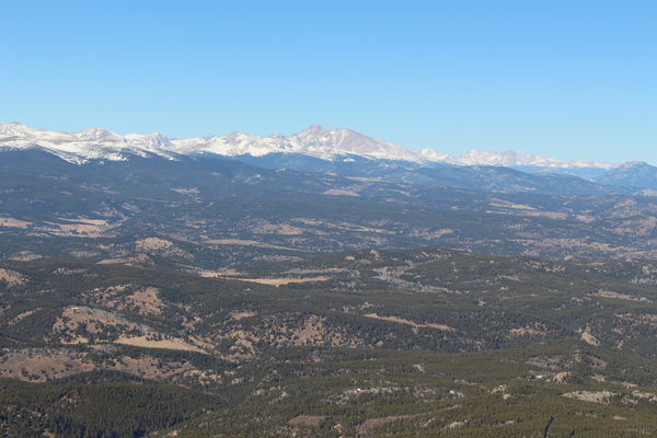
2022-12-11 Mount Meeker and Longs Peak from near Thorodin Mountain summit
This was a short hike of about 1.5 miles one way. Elevation change from low to high was about 1,200 feet as you can see from the plot. There is a faint trail which we followed up the mountain, but it doesn't start from Gap Road, but from the Harmsen Ranch trail in the meadow on the north side of Gap Road. Ascending the south facing slope provided only a thin layer of snow most of the way. There were no human tracks in the snow. On the way back, a stop at Harmsen Ranch took us a bit lower than the parking place.

2022-12-11 Harmsen Ranch with sign and Lazy Squaw Spire
For our return drive home we went west on Gap Road to CO Hwy 119, then south to Rollinsville, Nederland, then Boulder. This way was less driving on unpaved road.

2022-12-11 Elevation gain plot from Gap Rd to Thorodin Mountain summit
| Place Name | Elev [ft] | Accuracy [ft] | Position (lat,lon) |
|---|---|---|---|
| Parking for Thorodin Mountain | 9,436 | 30 | 39.87182,-105.42862 |
| Thorodin summit | 10,584 | 20 | 39.88452,-105.42861 |
© 2012-2022 Stefan Hollos and Richard Hollos
Tweet

blog comments powered by Disqus