The Iron Dike of Boulder and Larimer Counties
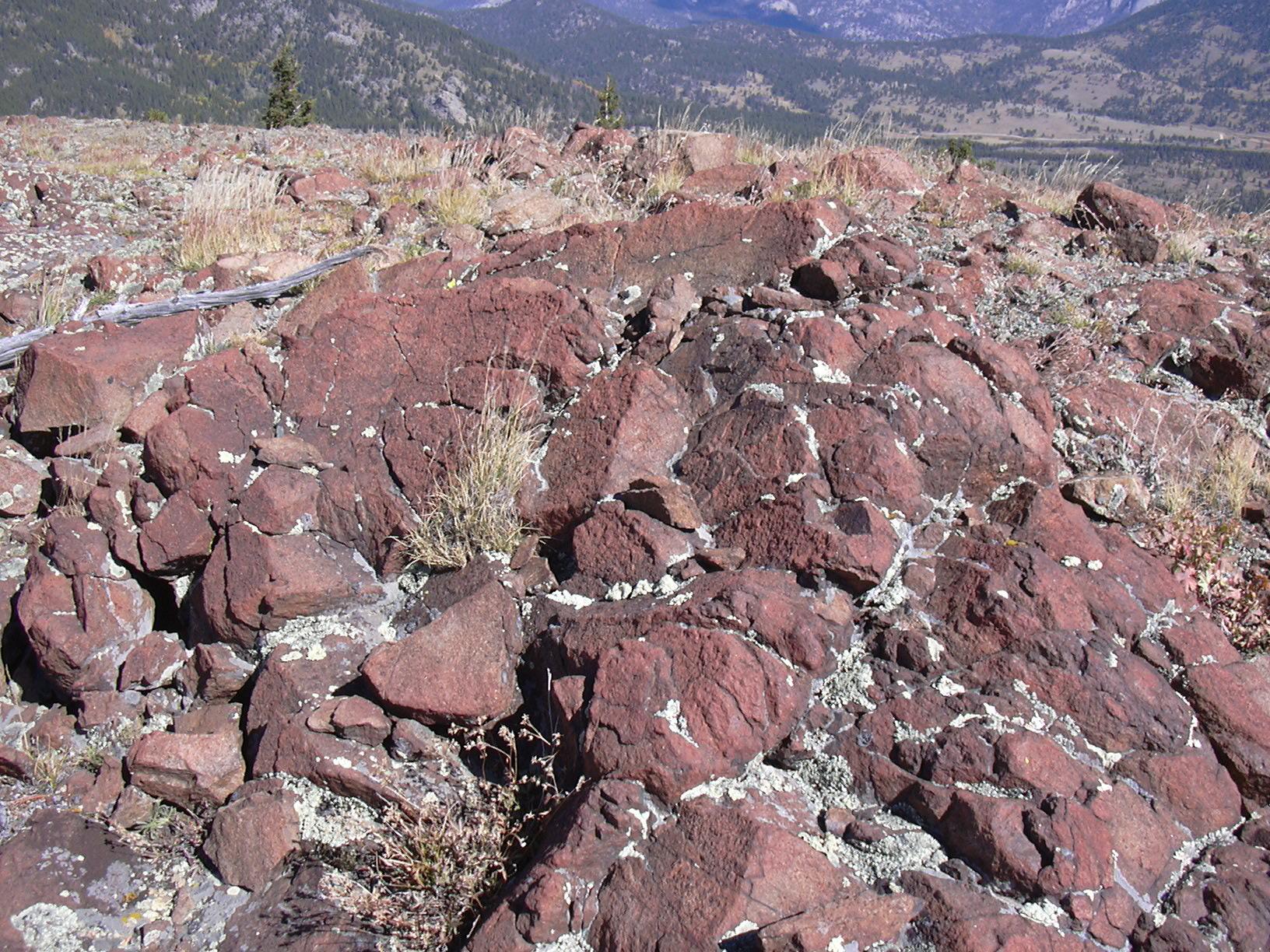
Iron Dike on summit of Steep Mtn, 09/26/04

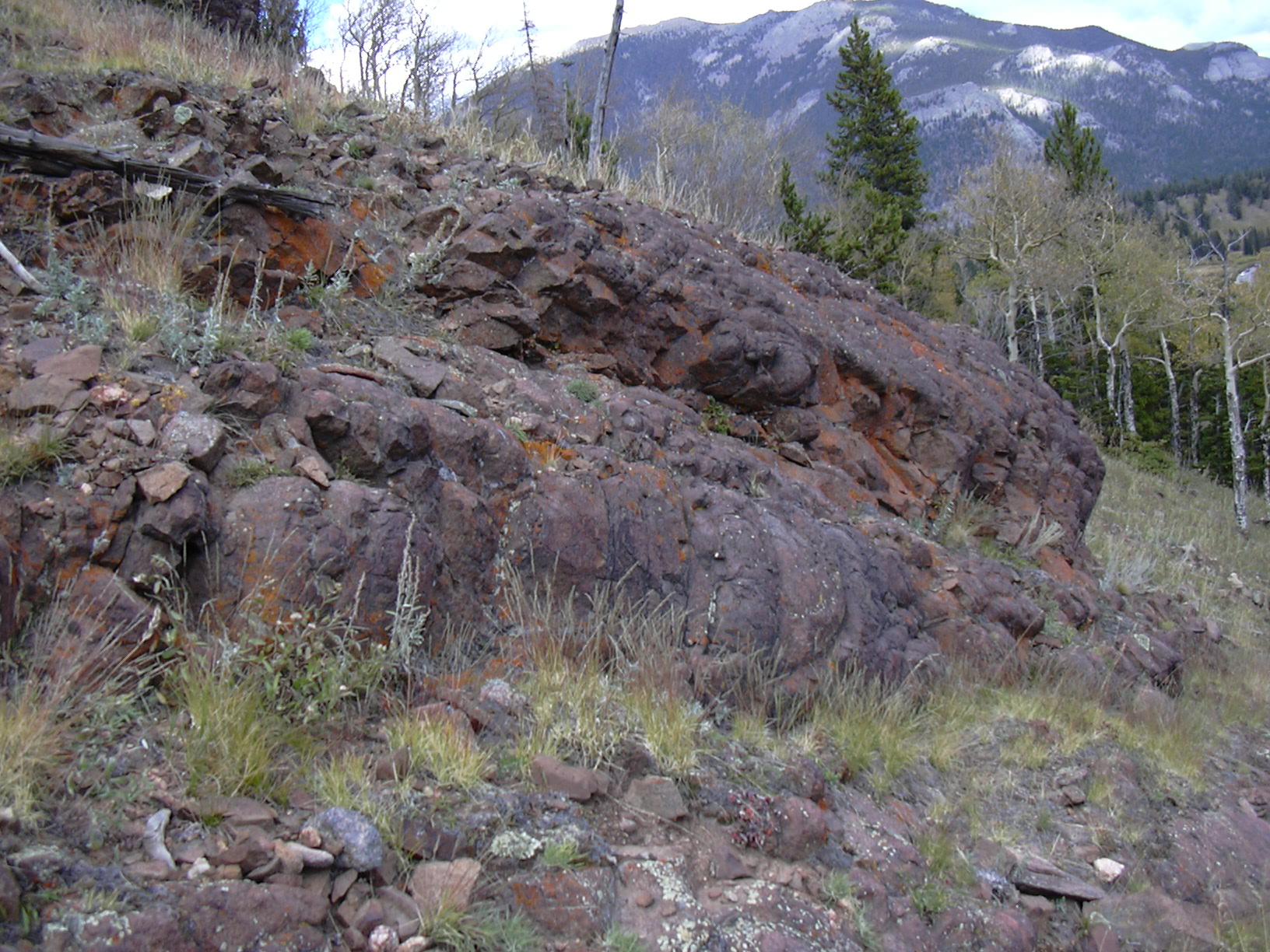
Iron Dike on south side of Steep Mtn, 09/26/04
Iron Dike at Hidden Valley, 09/26/04
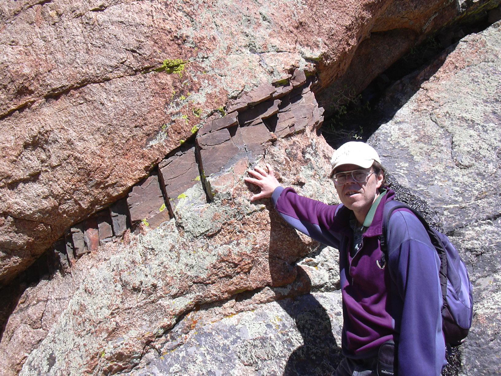
Iron Dike intrusion into granite on southern end of Ironclads, with Stefan, 06/05/05
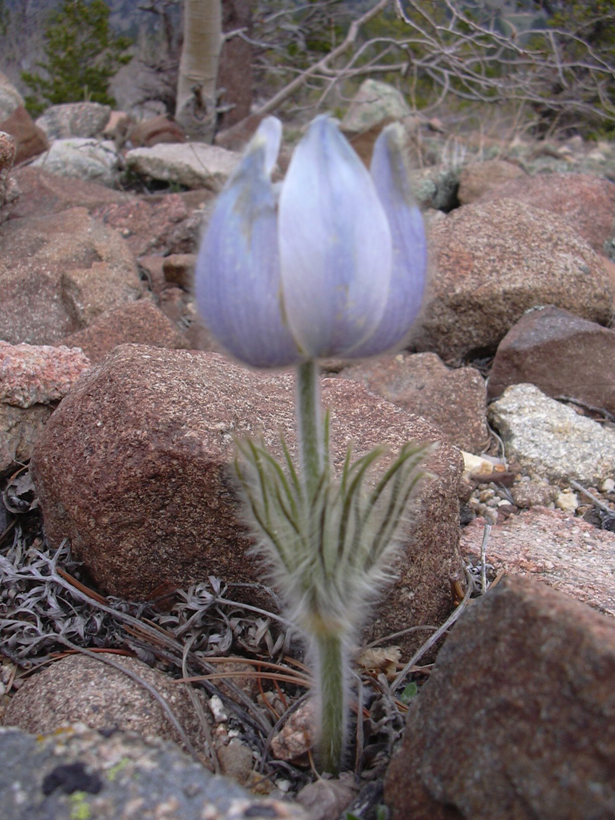
Pasque flower on Iron Dike, 05/12/07
The Iron Dike is one of the natural wonders of Boulder and Larimer Counties. It is an iron rich igneous rock intrusion that is 1.3 billion years old. In other words, it's a wall of rock that was formed by magma squeezing into a crack of the Silver Plume Granite which covers the northern Front Range of Colorado. The Silver Plume Granite is somewhat older, at 1.4 billion years old.
The Iron Dike is more weather resistant than the granite that surrounds it, so it usually extends several inches above the nearby granite. It spans the distance of about 38 miles (61 km) from Magnolia, just south of Boulder Canyon, to Mount Chapin in Rocky Mountain National Park, then picks up again in the Medicine Bow Mountains before disappearing beneath the younger rocks south of the Colorado-Wyoming border. It's width is typically 50 to 100 feet (15-30 meters).
We've made a map of the Iron Dike, created from those points we have visited and recorded with our GPS.
The rocks of the Iron Dike look much different than the neighboring granite. In places, its rock looks like rusted iron, almost black with some red. In other places it's bright red, or brown speckled with beige.
When the Iron Dike was born, the Earth was very different than it is now. It was a time before humans, before dinosaurs, before flowers, before birds, before mammals, before reptiles, before insects, before plants, and before fish. When it was born, multicellular life was just beginning. There was no life on land. In the oceans, the most complex organism was the sponge.
In the table below, are some GPS points where we have found the Iron Dike. Some convenient places to see it are:
- East side of Longs Peak Trailhead parking area.
- Sugarloaf Road.
- Peak to Peak Hwy at rest area about 1/2 mile east of Ferncliff.
- Hidden Valley, Rocky Mountain National Park.
The Iron Dike is great for hiking because the vegetation tends to not grow densely on it. Conifers especially don't seem to like the iron rich ground, although aspen grow on it. How about an Iron Dike Trail? 38 miles from Magnolia to Mt. Chapin. It might spur interest in geology, and science in general.
- Stefan Hollos and Richard Hollos
References
The age of the Iron Dike - a distinctive Middle Proterozoic intrusion in the northern Front Range of Colorado, William A. Braddock and Zell E. Peterman, The Mountain Geologist, Vol 26, No 4, Oct 1989, p97-99.
Petrology and weathering of the Iron Dike, Boulder and Larimer Counties, Colorado , Ernest E. Wahlstrom, Bulletin of the Geological Society of America, Vol 67, Feb 1956, p147-163.
| Place name | Elev [ft] | Accuracy [ft] | Lat/Lon |
|---|---|---|---|
| Iron Dike near Longs Peak Trailhead Parking area | 9435 | 41 | 40.27114/105.55592 |
| Iron Dike east of Ferncliff, next to Hwy | 8444 | 16 | 40.18779/105.49952 |
| Iron Dike east of Ferncliff, south of previous point | 8807 | 10 | 40.18438/105.49763 |
| Iron Dike east of Ferncliff, south of previous point | 9064 | 16 | 40.17912/105.49549 |
| Eastern edge of Iron Dike on Storm Pass Trail | 10274 | 19 | 40.29174/105.56863 |
| Western edge of Iron Dike on Storm Pass Trail | 10247 | 28 | 40.29268/105.57246 |
| Peak 9331 (north of Ironclads) | 9331 | ? | 40.1753/105.4931 |
| North end of Iron Dike ridge on Peak 9331 | 9361 | 12 | 40.17600/105.49338 |
| South end of Iron Dike ridge on Peak 9331 | ? | ? | 40.17437/105.49280 |
| Our most southern point on Iron Dike before going off to Ironclads | 9266 | 16 | 40.17299/105.49223 |
| Iron Dike at southwest corner of Ironclads | 8739 | 19 | 40.16262/105.48882 |
| Eastern edge of Iron Dike near Peak 8312 (Lefthand Canyon) | 8261 | 24 | 40.07390/105.43175 |
| Western edge of Iron Dike near Peak 8312 (Lefthand Canyon) | 8329 | 17 | 40.07370/105.43330 |
| Iron Dike on Sugarloaf Road | 7674 | 29 | 40.02197/105.40012 |
| Iron Dike next to Gold Lake Ranch | 8669 | 17 | 40.08796/105.44756 |
| Iron Dike south of Gold Lake Ranch | 8698 | 34 | 40.08626/105.44576 |